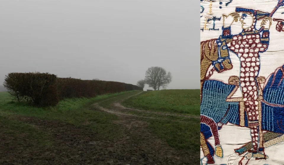
Tracing the Footsteps of the Norman Conquest: Photographer Peter Caton Revisits the Landscapes of 1066

Nearly a millennium after a shifting tide at Pevensey Bay carried the forces of a foreign duke onto English shores, the echoes of the Norman Conquest remain quietly embedded in the British landscape. A new, compelling photobook titled After 1066: Photographs of an English Landscape, captured by internationally acclaimed documentary photographer Peter Caton and published by RRB Photobooks, undertakes a visual excavation of this transformative historical epoch.
Instead of relying on grand historical reenactments, dramatic lighting, or overt symbolism, Caton’s lens treats the English countryside with a restrained, objective gaze. The resulting body of work asks a deceptively simple question: Nearly a thousand years after the events that redrew the map of power in medieval Europe, what can still be seen—and felt—in the terrain itself?
Timed to coincide with the monumental, historic return of the Bayeux Tapestry to the United Kingdom in September 2026—its first visit in almost a thousand years—and ahead of the millennium of William the Conqueror’s birth in 2027, Caton’s project bridges the chasm between distant medieval warfare and the mundane reality of modern geography.
Main Facts: The Vision Behind After 1066
The core premise of After 1066 rests on a jarring juxtaposition: the sheer ordinariness of the locations that once bore witness to some of the most violent and consequential turning points in British history.
- The Artist: Peter Caton, a globally recognized documentary photographer with over two decades of experience capturing humanitarian crises and environmental shifts across Asia, Africa, and South America for organizations such as the Red Cross, UNHCR, and Greenpeace.
- The Route: Caton retraced the historical path carved by Duke William of Normandy’s army following their landing in September 1066, tracking their movements from the southern coast through crucial river crossings, fortresses, rebel strongholds, and the devastated northern territories.
- The Publication: Released by RRB Photobooks, the monograph features an insightful introductory essay by Tracy Marshall-Grant, contextualizing Caton’s landscapes not merely as backdrops, but as living witnesses to history.
- The Cultural Context: The publication aligns with a renewed national focus on the Norman Conquest, sparked by the British Museum’s blockbuster exhibition featuring the Bayeux Tapestry in late 2026 and the upcoming 2027 birth millennium of William the Conqueror.
Chronology of the Conquest: Tracing the Path of Duke William
To understand the geographical weight of Caton’s photographs, one must retrace the harrowing path taken by the Norman army in the autumn and winter of 1066—a campaign that fundamentally severed England’s Anglo-Saxon ties and bound its future to continental Europe.
[September 1066: Pevensey Bay] ---> [October 1066: Battle of Hastings] ---> [Late 1066: Wallingford & Berkhamsted] ---> [1069-1070: The Harrying of the North]1. Pevensey Bay, East Sussex: The Landing
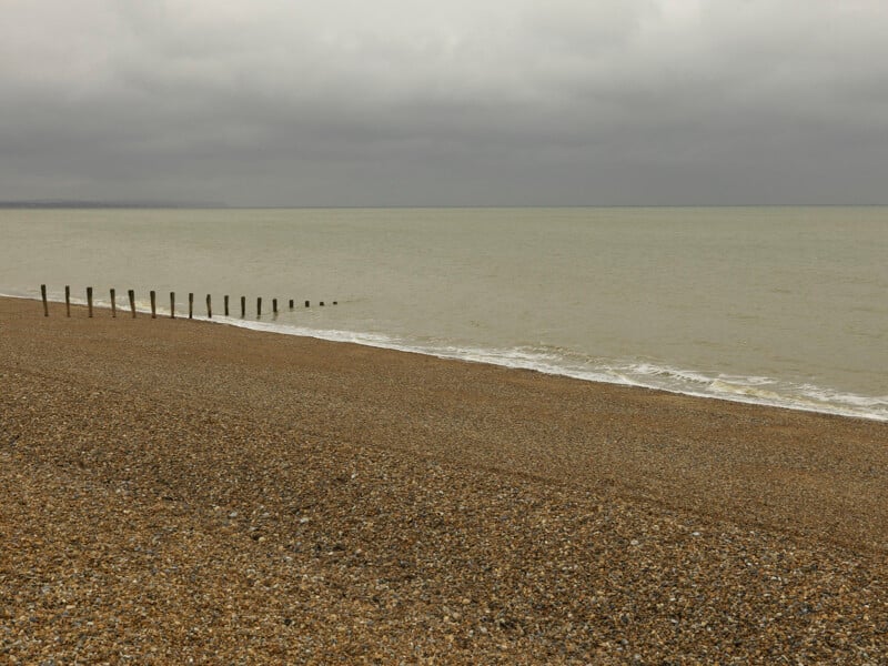
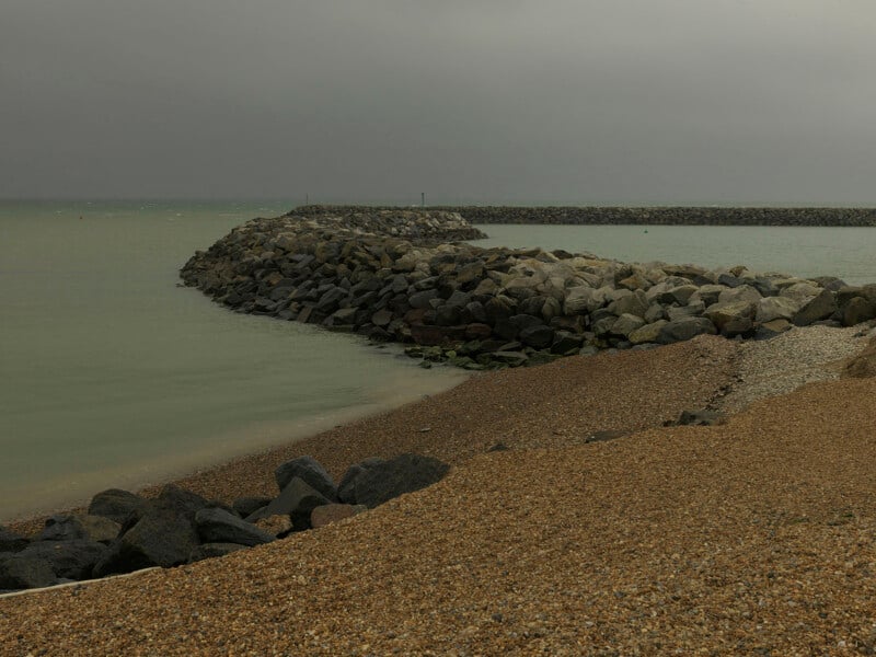
In late September 1066, Duke William of Normandy landed his fleet unopposed at Pevensey Bay. Today, the shoreline looks vastly different than it did in the medieval era. Modern coastal defenses, breakwaters, and modified shingle beaches reshape a coastline that once offered a vulnerable gateway to the Anglo-Saxon realm. Caton’s images of Pevensey capture a serene, grey sea under a blanket of clouds, belying the massive armada that once anchored in its waters.
2. Battle and Hastings: The Clash of Crowns
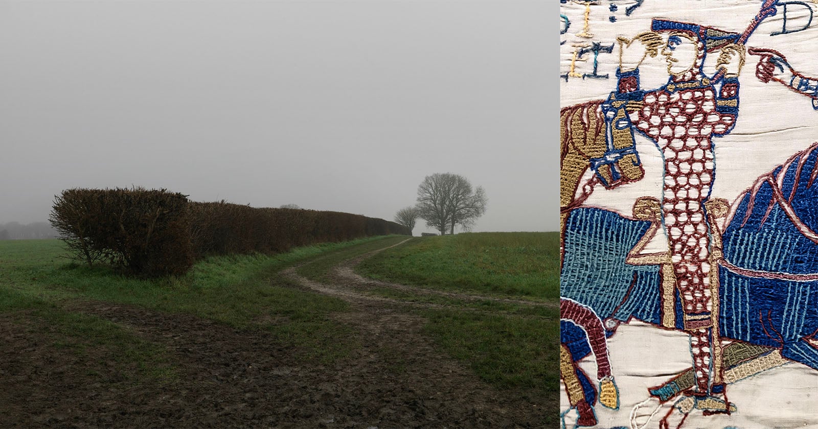
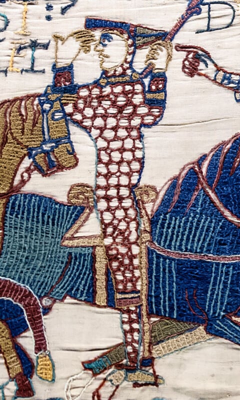
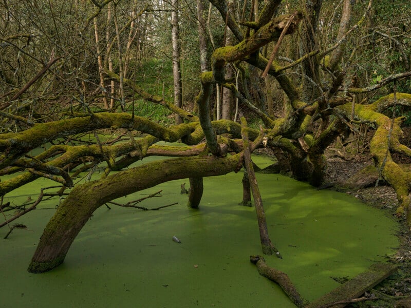
Moving inland, the journey leads to the quiet ground below the ridge at Battle, East Sussex. Here, on October 14, 1066, the fate of England was decided. The Norman forces clashed with the Anglo-Saxon army led by King Harold Godwinson. Harold was killed—infamously depicted in the Bayeux Tapestry—effectively ending the Anglo-Saxon line of monarchs. Caton photographs the surrounding landscape, including the wet woodland where retreating Saxon forces were pursued and cut down, using a quiet observational style that strips away romantic mythmaking.
3. Wallingford and Berkhamsted: Securing the Throne
Following his victory, William did not march directly on London. Instead, he consolidated his power by securing strategic supply lines and crossings. At Wallingford in Oxfordshire, Caton documents the flooded lands beside the River Thames where William secured a vital river crossing during his advance.
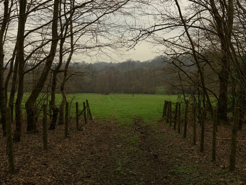
From there, the route winds to Berkhamsted in Hertfordshire. Caton’s camera captures the muddy tracks leading toward the earthworks of Berkhamsted Castle. It was at this very location in December 1066 that the remaining English nobility and senior clergy—including Archbishop Stigand—formally submitted to William, handing over their allegiance and securing his crown.
4. Ely and Yorkshire: Rebellion and Repression
The Norman Conquest was not completed in a single season. Resistance flared across the realm, most notably in the marshlands of the Fens at Ely, Cambridgeshire, where English rebels under Hereward the Wake mounted a fierce, last-ditch resistance. Caton’s lens captures the stark reedbeds and sprawling waterways that once served as an impassable refuge.
Further north, Caton traveled to the recovered farmland of Yorkshire. These fields bear the spectral memory of the "Harrying of the North" (1069–1070)—a brutal scorched-earth campaign ordered by William to permanently crush Northern rebellions, which resulted in widespread starvation, depopulation, and economic devastation from which the region took generations to recover.
Supporting Data and Artistic Approach
Caton’s departure from traditional landscape photography lies in his deliberate rejection of dramatic elements. Rather than chasing "golden hour" lighting, moody fog banks, or picturesque tourist angles, he adopts a neutral, objective stance.
According to Tracy Marshall-Grant’s introductory essay in the monograph, Caton’s methodology asks the viewer to reconsider the very nature of land:
"His photographs ask us to see landscape not as simply backdrops to history, but living witnesses to it."
This documentary approach mirrors Caton’s extensive background in photojournalism. Having spent over two decades chronicling the harsh realities of climate change and humanitarian crises for outlets like The Guardian, The Washington Post, The Sunday Times Magazine, Esquire, and international relief agencies, Caton possesses a unique ability to find profound narrative depth in unassuming places.
"After 1066 began with a simple question: nearly a thousand years after the Norman Conquest, what can still be seen in the landscape?" Caton reflects. "I was surprised by how ordinary these places were. Rather than trying to recreate history, I wanted to photograph the landscapes as they exist today and encourage people to look more carefully at places that have quietly shaped England’s history."
Official Responses and Cultural Timing
The release of After 1066 arrives at a critical cultural juncture for British institutions and heritage bodies. The intersection of Caton’s project with the return of the Bayeux Tapestry to British soil has amplified public interest in the events of the eleventh century.
While museum officials have wrestled with the immense public demand—even implementing strict preservation and photography bans during the blockbuster exhibition’s opening weeks—independent artists like Caton are taking a different approach. Instead of focusing on museum artifacts behind glass, Caton’s work redirects public curiosity back into the open air, challenging citizens to walk out into the fields, riversides, and coastal bays that witnessed the birth of modern England.
Historians and cultural critics have praised the project for grounding abstract historical dates into physical reality. By highlighting places like the flooded Thames banks at Wallingford or the unassuming muddy tracks of Berkhamsted, the book bridges a psychological gap. It reminds contemporary audiences that history is not confined to textbooks or royal galleries; it is written into the dirt beneath our feet.
Implications: Re-evaluating Our Relationship with the Past
What does it mean for a landscape to "remember" an invasion that occurred nearly a thousand years ago? After 1066 suggests that while time heals physical scars, the structural, political, and geographical foundations of a nation remain inextricably linked to the paths forged by conquerors.
The implications of Caton’s work extend beyond mere historical appreciation. In an era dominated by rapid digital consumption and hyper-accelerated modern development, these photographs serve as a quiet meditation on endurance. The marshes of Ely have been drained; the coastal defenses of Pevensey Bay have shifted; the forests near Hastings have been managed and thinned. Yet, the foundational contours of the land—the rivers that demanded crossings, the hills that offered tactical advantages, the valleys that suffered desolation—remain steadfast.
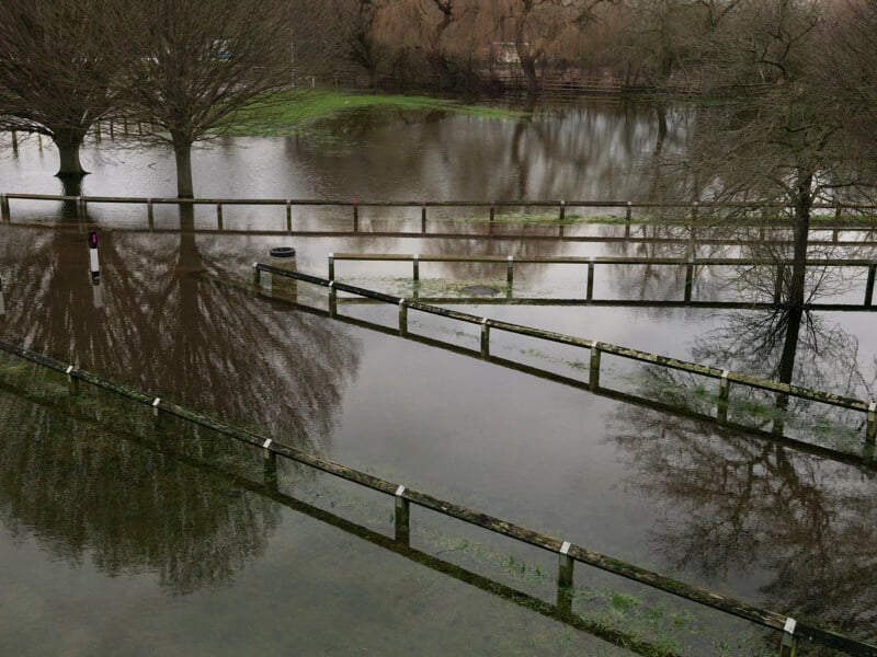
Through After 1066: Photographs of an English Landscape, Peter Caton successfully transforms ordinary contemporary geography into an evocative archive. By stripping away centuries of myth and romanticism, he invites viewers to stand quietly in the English countryside and recognize that the ground they walk upon is still shaped by the violent birth pangs of a medieval state.